

Verified Views
What is a Verified View?
A verified view is an accurate photomontage. Verified means that the information about the camera location and key reference points in the view have been surveyed and aligned to confirm accuracy. Verified views are made with real world information, such as GPS locations, site-specific data and photographs.Verified Views are also referred to as Accurate Visual Representations (AVR) and Visually Verified Montages (VVM). These images are requested by planning authorities to support applications for developments within a sensitive context.
Rendered Image’s verified view imagery has been used successfully in many planning applications, appeals and public enquiries. Crucially, our verified views deliver confidence and transparency – they can be used to reassure the audience as to the accuracy of CGI representations of architectural, landscaping and development projects.
What is our verified view methodology, and what can we do?
Our process is in accordance with best industry practice. This is outlined in• The Landscape Institute Guidelines for Landscape and Visual Impact Assessment, 3rd Edition (April 2013)
• Scottish Natural Heritage Visual Representation of Wind Farms Guidance Version 2.2 (February 2017) and
• Landscape Institutes Visual Representation of Development Proposals Technical Guidance Note 06/19 (June 2019)
We partner with qualified Chartered Surveyors to complete the study. A detailed methodology is provided that describes our process and is suitable for submission as part of a Planning Application and Landscape Visual Impact Assessment (LVIA).
Survey data is imported into our 3D software to locate the camera and accurately align it with the 3D model of the proposed design.
There are 4 types of output designed to meet a variety of needs.
Level 0 occluded coloured area
Level 1 occluded wireframe
Level 2 flat shaded single material model
Level 3 full proposed material model and replication of lighting in the photograph

What we need from you
To provide a free quotation all we need is a brief description of the verified views you require, with a copy of any relevant photographs and drawings you may have at this stage.Our priority is to ensure you get exactly what you want; we will always make our own ideas and intentions clear during the project and we will listen carefully to your comments and suggestions.
Timescales
Once started, this type of project is usually completed in 2-4 weeks.Any questions?
If you have any questions about our verified views service or the techniques we use, please get in touch. Call us on 020 3808 8234, use our enquiry form, or email us via enquiry@renderedimage.ukFeatured Projects
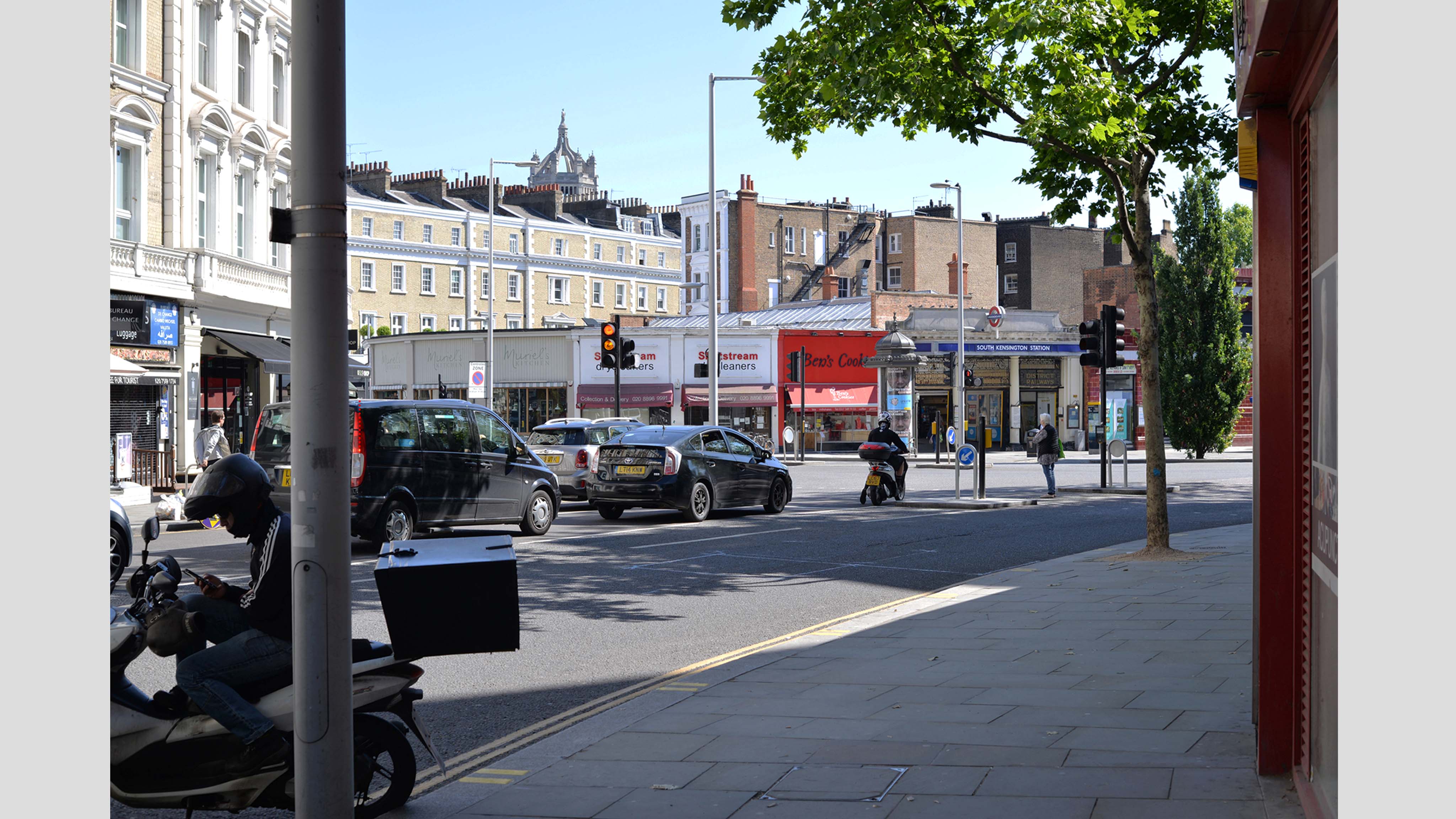
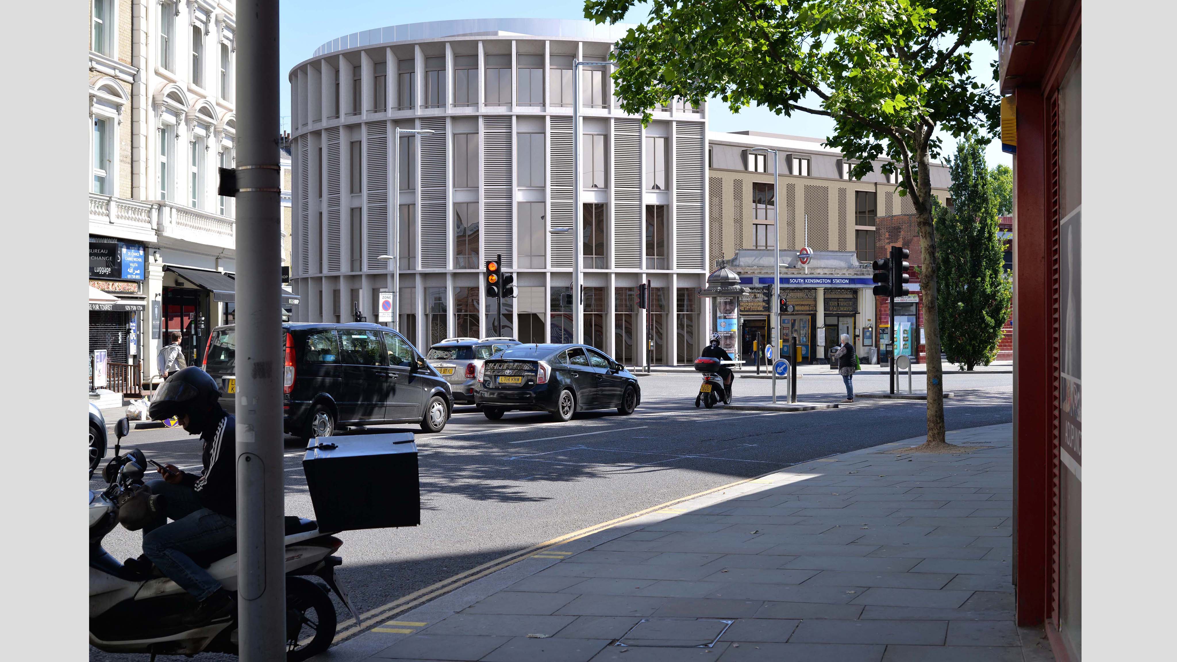
Tfl South Kensington
Kensington & Chelsea, London | Level 3 Verified View | mixed-use development | images used for discussion within planning meeting
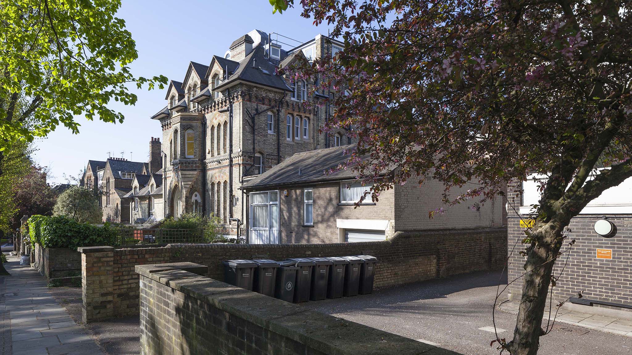
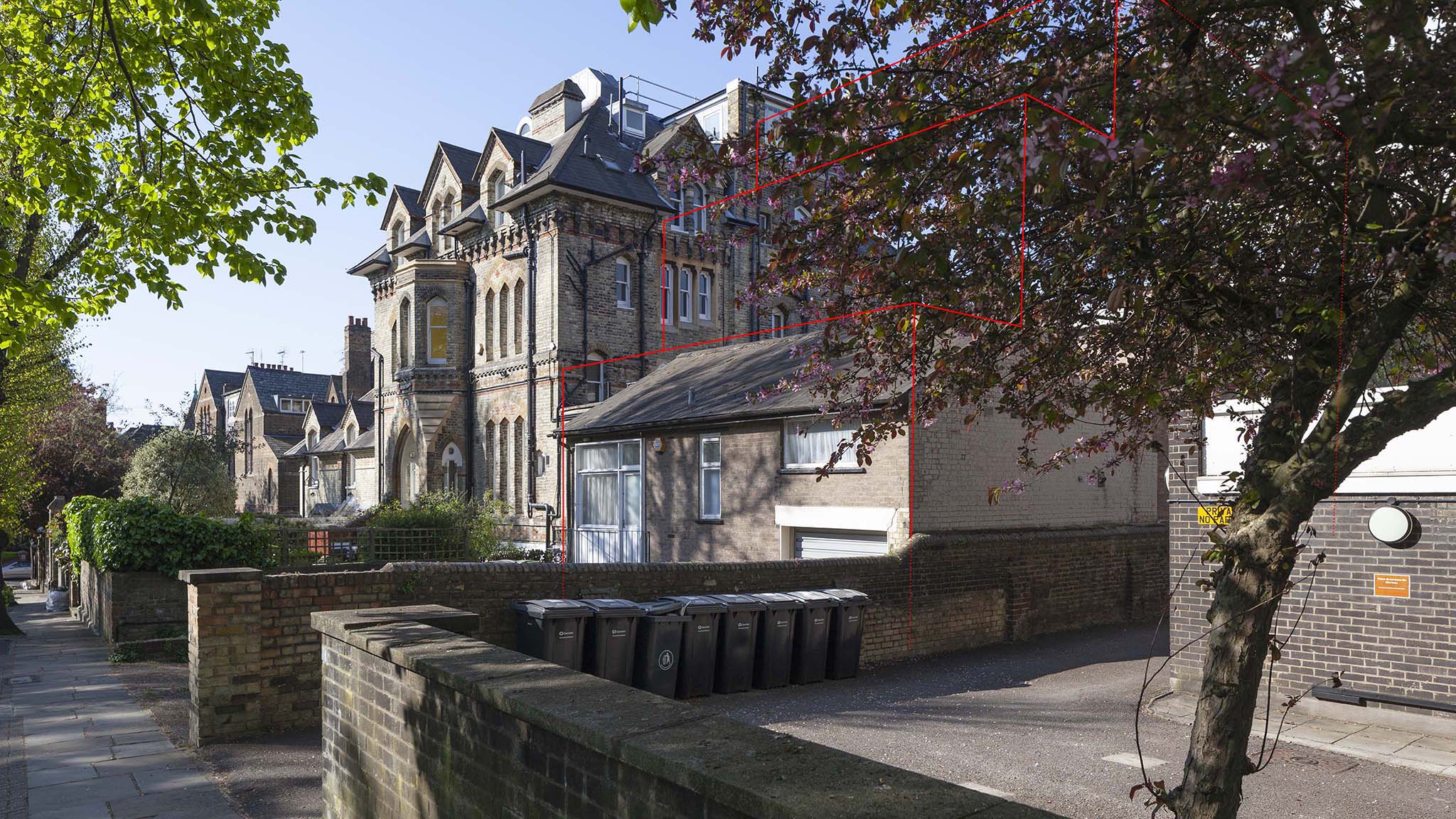
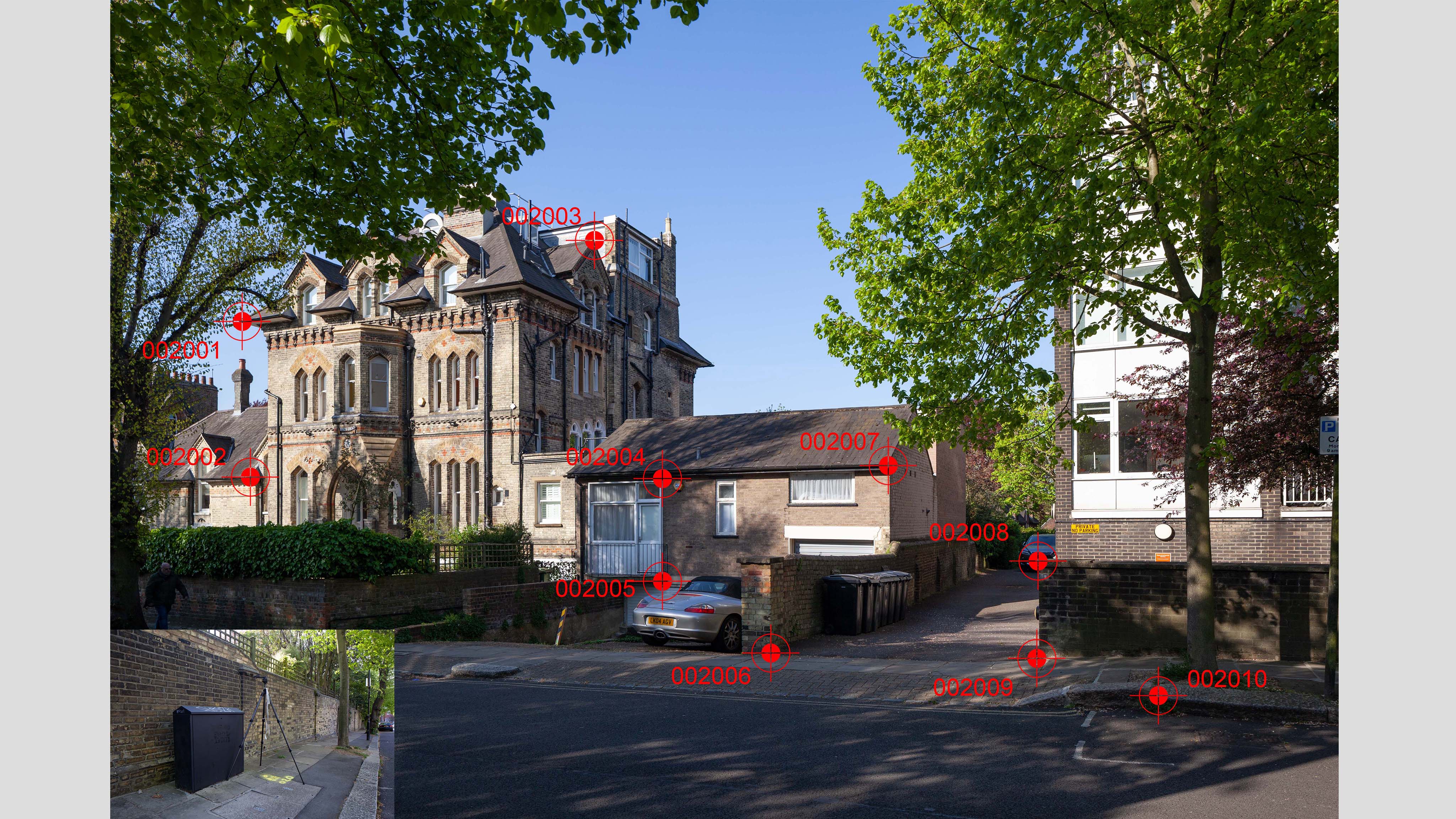
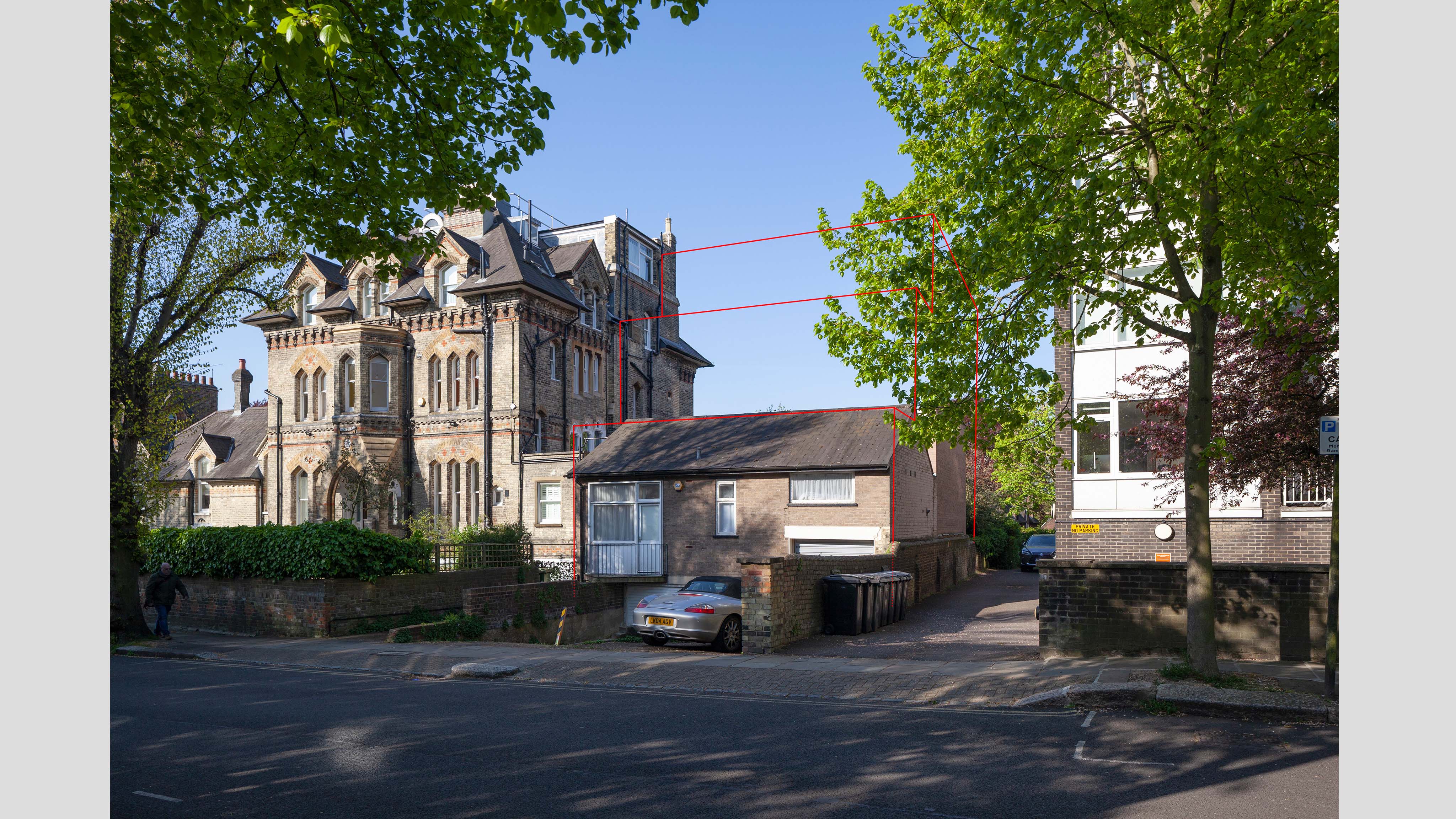
Lyndhurst Terrace
Hampstead, London | Level 1 Verified View | single dwelling | images used as part of planning application
Buckinghamshire | Level 3 Verfied View | 80 dwelling development | images used as part of the planning assessment
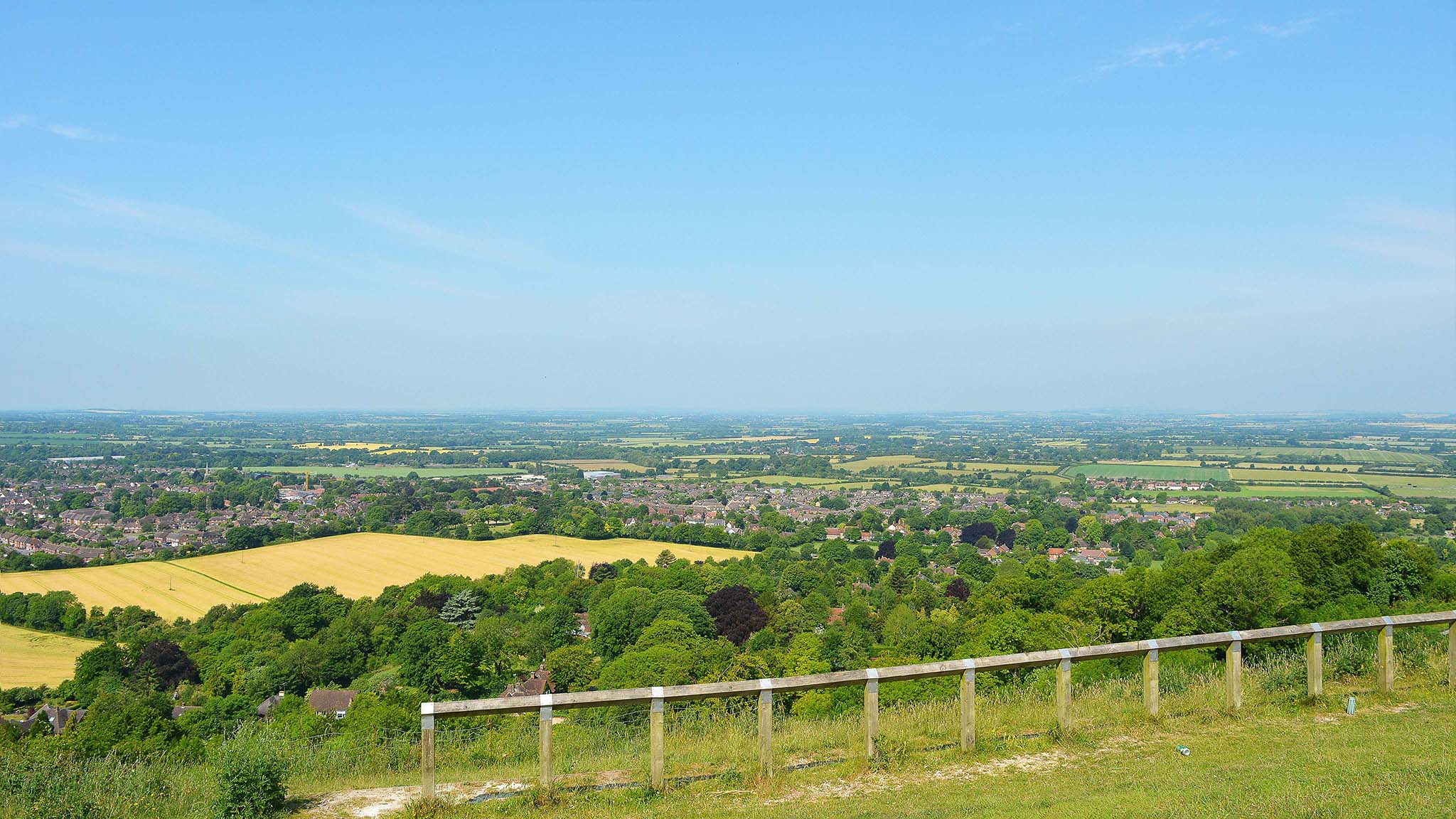
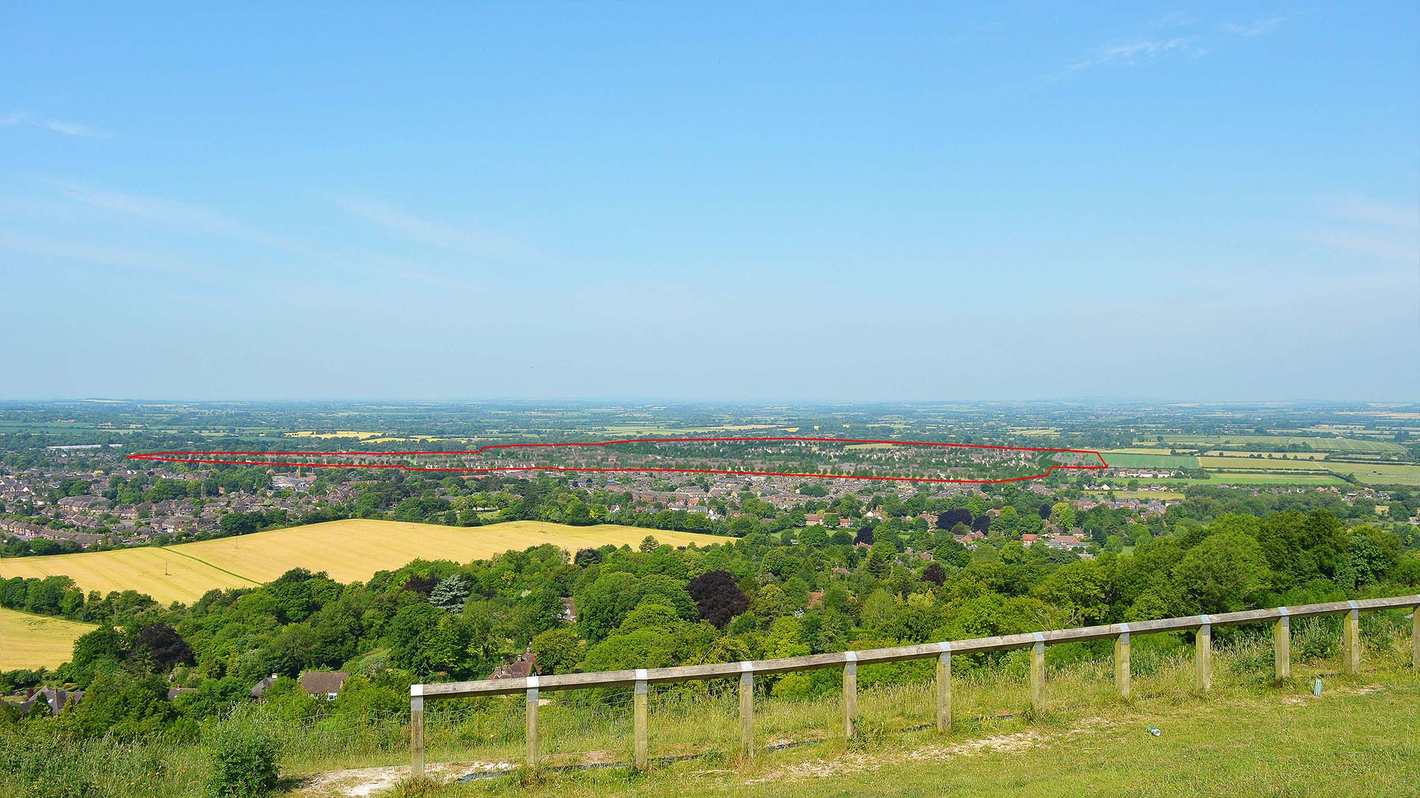
Princess Risborough
Buckinghamshire | Level 3 Verified View | 2480 dwelling development | images used as part of the visual impact assessment planning submission
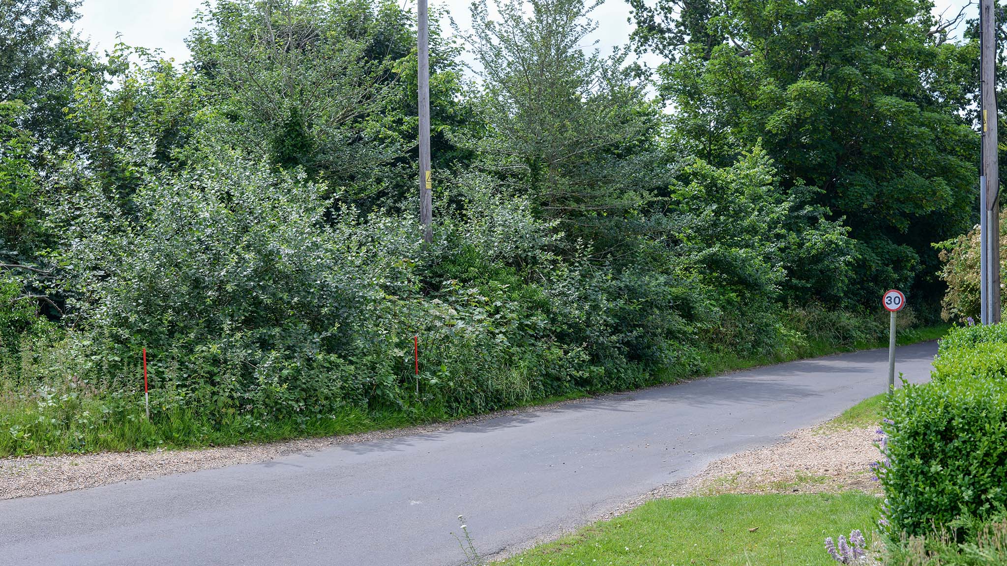
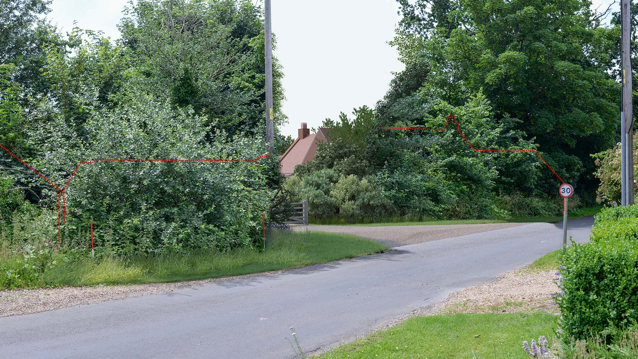
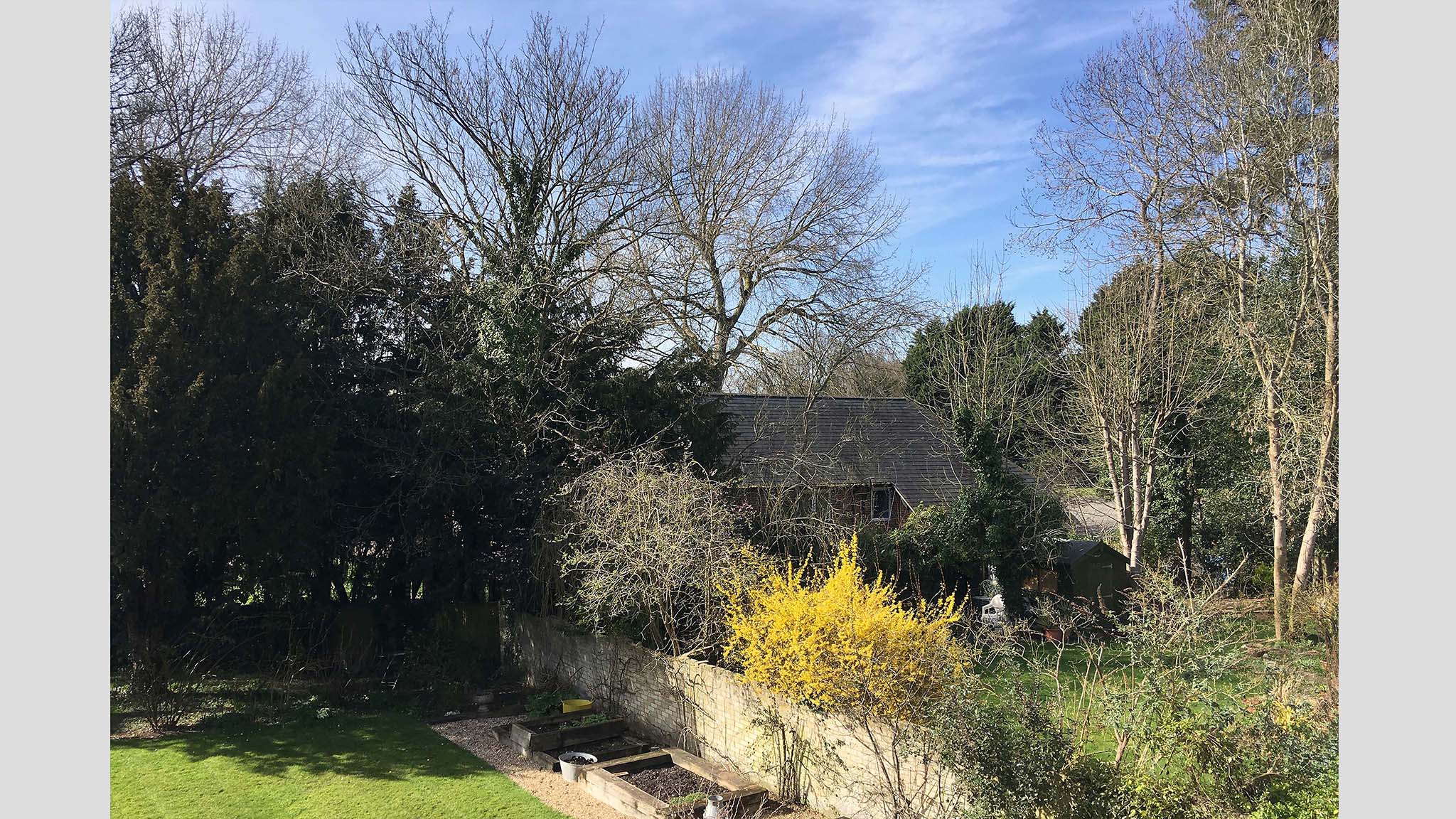
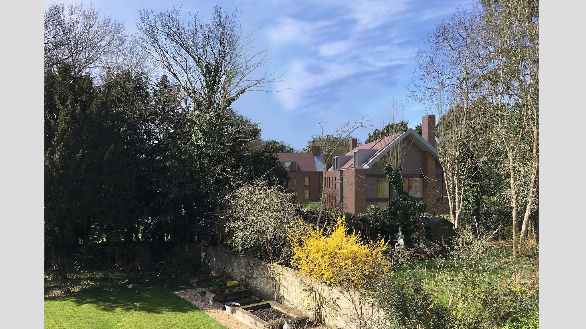
Whitchurch Hill
Oxfordshire | Level 3 Verified View | single rural dwelling | images used as part of the planning application
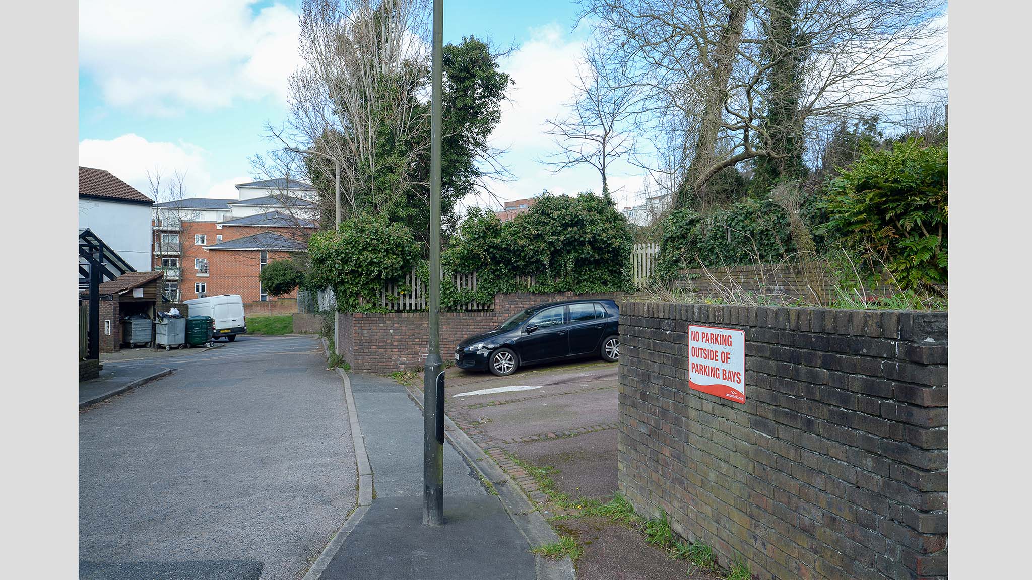
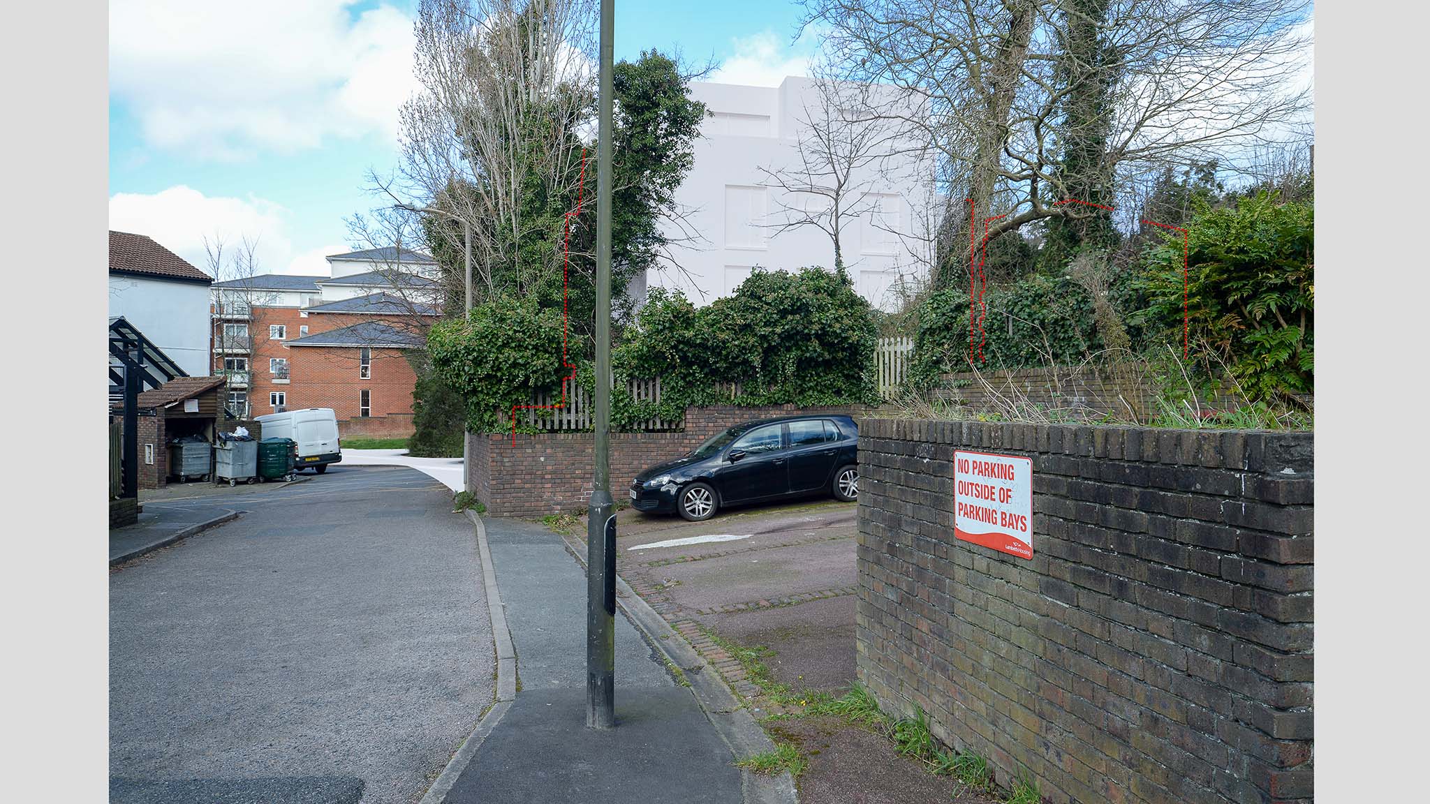
Leigham Court Road
London | Level 2 Verified View | 37 dwelling development | images used as part of the planning application
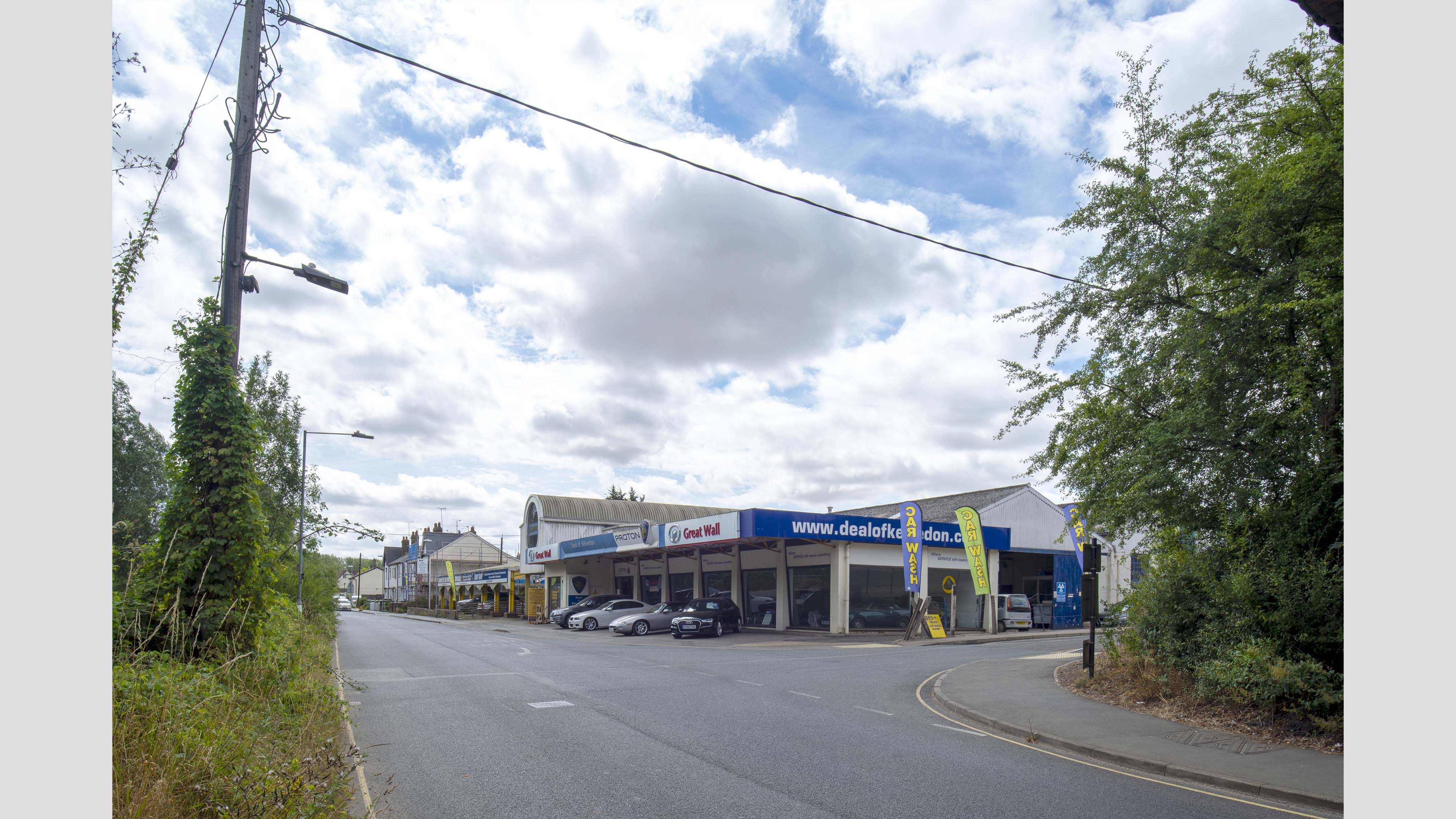
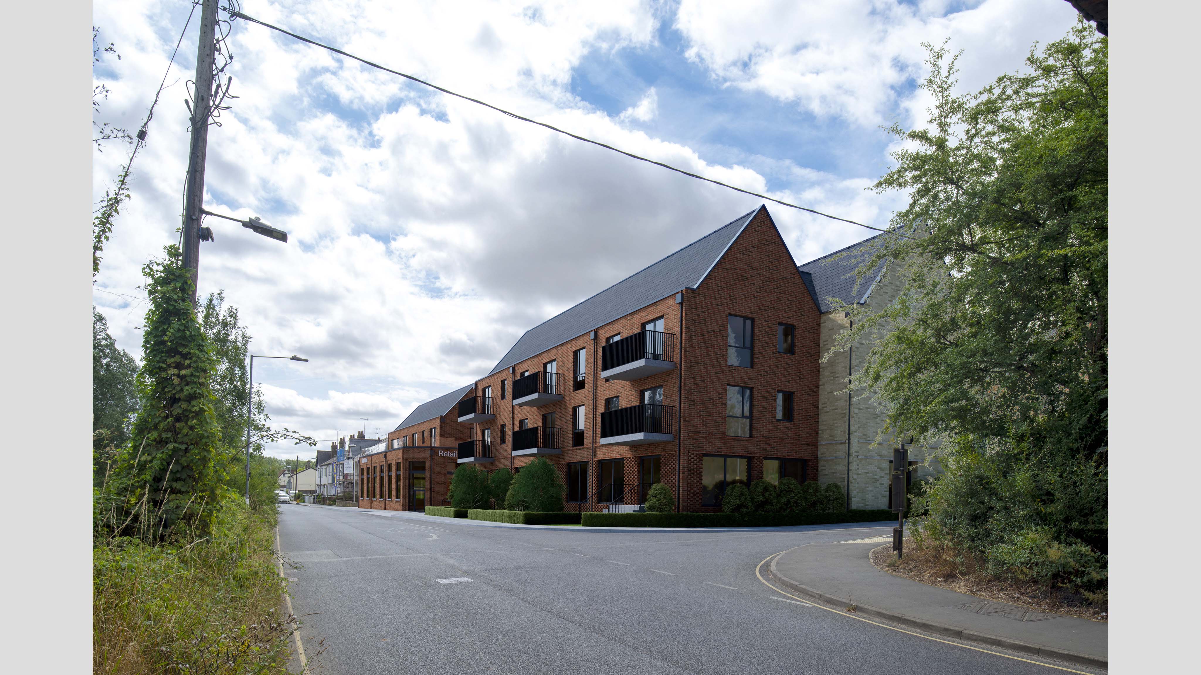
Kelvedon
Essex | Level 3 Verified View | mixed-use development | images used as part of planning application